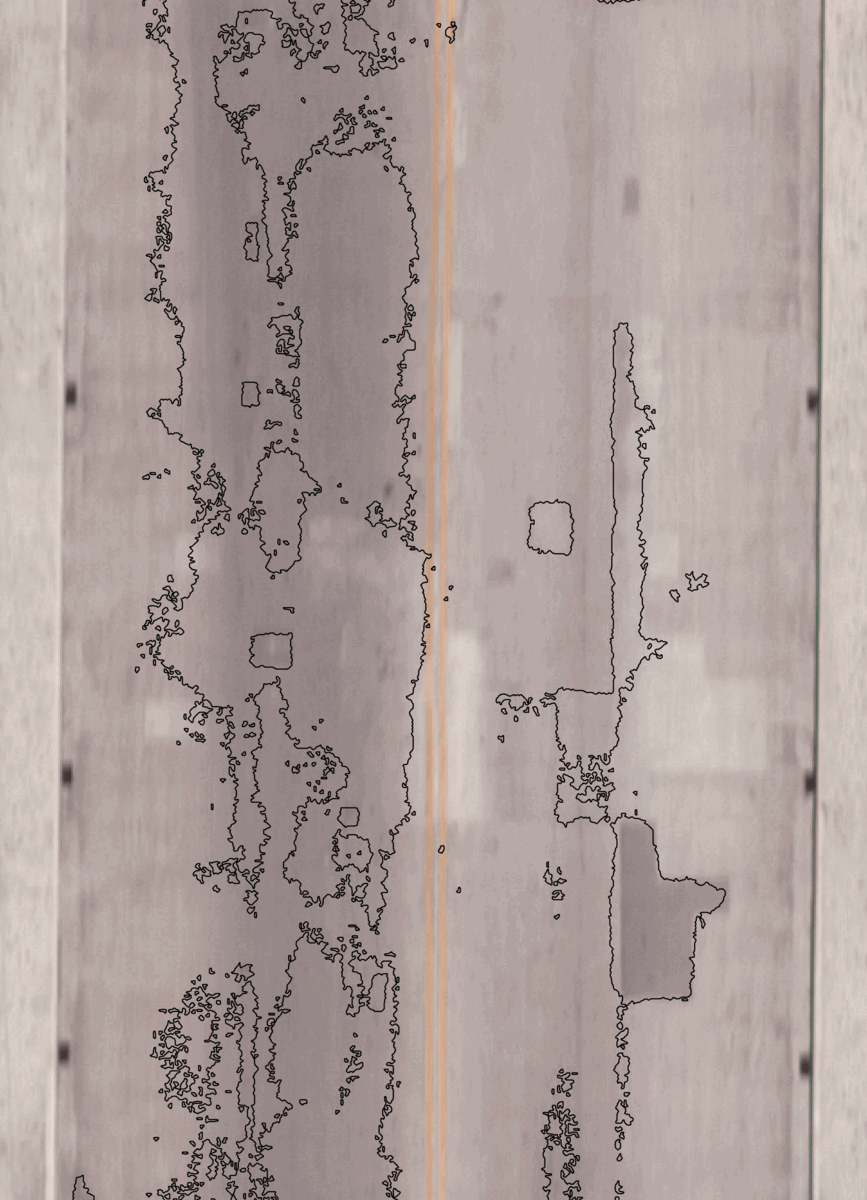
It is crucial to understand the structural integrity of bridge decks, monitor changes, and plan for informed repairs of this critical infrastructure. Naturally, it takes both time and money to do an accurate assessment. There are various methods to choose from that can often be disruptive to normal traffic flow and provide somewhat indeterminate results. Thermography or thermal infrared (TIR) is one viable solution for infrastructure. TIR is a fascinating remote sensing technology that can help identify otherwise undetectable structural problems well before they reach the surface of bridge decks and long before they can be seen during close-range visual inspections. With NV5 Geospatial's new and innovative airborne TIR approach, high-resolution data is used to analyze the structural integrity of bridges using TIR imagery captured from a fixed-wing airborne platform in a low-altitude pass. This provides impressive results and validates the use of TIR analytics to identify structural anomalies in concrete. TIR is defining a new path for a cost-effective, highly accurate analysis that will reap considerable benefits for DOTs and Structural Engineers.